Home | Pioneers | Contact Us | Copyright/Disclaimer
| COOMA
TOWN HISTORY Early Cooma |
|
THE MONARO 1824-1850
pattrick@bigpond.com.au
Discovery etc.
Discovered in June 1823 by Captain Currie, but not explored or surveyed.
The district was settled as far south as Gegedzerick (Berridale) by 1827,
DrGibson had cattle at Kiandra in 1839, they perished.
The Boundaries.
I didn't think the boundary of the Monaro was any different then than it is
now. I believed that it took in the tableland or plateau bounded by the
mountains in the east, south and west. I thought that its northern boundary
would be just north of Bredbo but:
Mitchell suggests that...."Monaro originally included the whole of the
southern tablelands from Michelago to Gippsland and across to
Kiandra....... in more recent years (1926) it has generally been recognised
as comprising that network of towns and villages.....that took in Michelago,
Bredbo, Umeralla (Chakola), Cooma, Nimmitabel, Berridale, Dalgety, Jindabyne,
Adaminaby and Kiandra, with a large trace of country between Cooma,
Braidwood and Queenbeyan. Bombala and its associated towns may be
considered to constitute a separate area under the name of Southern Monaro"
Following is an extract from William Henry Wells' 1848 Geographical
Dictionary or Gazetteer of the Australian Colonies: MANAROO, MENAROO (Or Monaroo);
One of the squatting districts of NSW,
adjacent to the counties of St Vincent and Murray, keeping the right bank of the
Murrumbidgee, but extending over the whole district known by the name of the
Menaroo plains; it contains 1916 inhabitants, viz.: -1321 males and 595 females,
with 185) houses. The stock of the district is reckoned at 4544 horses, 113,291
head of horned cattle, 623 pigs, and 307,596 sheep. This country, known as
Brisbane Downs, is called by the natives Moneroo, it is not exactly a plain as
generally denominated, but is a series of gentle
undulations, the soil rich and fertile, and the land gently diversified with
hill and dale lightly timbered, and remarkably well watered. The level of the
plains is an elevated tableland or terrace parallel to the coast, and affording
a firm basis for the Snowy Mountains, Australian Alps, or the Great Warragong
chain to spring from. These plains form a square of about 100 miles in extent,
and present a country well fitted in every respect for the residence and
sustenance of civilized man. The district of Menaroo contains a larger extent of
land available, whether for pasture or agriculture, than the whole island of
Tasmania. This district has for its outlet the convenient and safe harbour of
Twofold Bay, situated in the county of Auckland, about 25 miles to the northward
of Cape Howe. The plains of Menaroo, which are at least from 2000 to 3000 feet
above the level of the sea, and of which, in winter, the climate is exceedingly
cold, is now occupied by a daily increasing multitude of squatters. This country
was discovered by Captain Currie, R.N., in 1823, in the course of an expedition
to the southward, and named by him in honor of the Governor "Brisbane
Downs," now called Menaroo. The rivers watering this district are the Deua,
Shoalhaven, Queanbeyan, Murray, Murrumbidgee, and Mitta Mitta. The most
conspicuous mountains are the Australian Alps, the highest elevation of which is
Mount Kosciusko, Mount Garangura, Coruncal, Dargal, Mount Murray: Mount
Dromedary, on the sea coast, is 3000 feet high. - Steve Painter
The Towns.
ADAMINABY (SEYMOUR),
A cattle station prior to 1860 (Kiandra Gold Rush),
1860 Joe Chalker opened the travelers Rest hotel
1861 the store was built by Michael Stokes in the same year he sold it to GY
Mould and then became the Postmaster.
1861 Austin's Hotel was built
1861 The first land sale was held.
1864 Police station built
1885 Proclaimed the town of Seymour
1886 Proclaimed the town of Adaminaby
BERRIDALE
the town grew around the homestead store of William Oliver, the cottage was
used as a wayside inn.
1869 Post office established with Thomas lynch in charge
1870 Oliver built a two story granite store and the original store became
the Berridale Inn
1890 Telegraph office opened
BUNYAN (REID'S FLAT)
1832 the Inn keeper was William Stanton
1838 Abraham Moses set up the Maneroo stores
1841 The Squatters arms was built
1860 John Cullen was appointed Postmaster.
1889 Railway line opened to Bunyan.
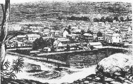
COOMA (KUMA) I don’t have much,
1836 Only a stone hut belonging to cooper and levy
1847; The Court of Petty Sessions was established.
1849; The survey of the town was completed
DALGETY (BUCKLEY'S CROSSING)
1859 Population was about 59
1860 Post Office established, Mary Barnes in charge.
1860 Richard Barnes operated the punt.
1874 Surveyed
JINDABYNE
1847 Flour mill was being operated by William Jardine.
1861 Hotel and store was built by Charles Solomon
1862 Post office was established with Phillip Adams in charge
1862 Police station established
KIANDRA
1859 Pollock brothers discovered gold.
1860-61 Gold Rush.
1885 Proclaimed a town.
MICHELAGO
1838 Union Hotel established at Keefe's Plains
1859 Police station established
1860 Post office was opened by Robert Cameron
NIMMITABEL (NIMITY BELLE)
About 1840 the locals started calling the village Nimoitebool
1845 On Townsends map as Nimmitabel
1858 Church was built
1857 Renewal of license for hotel
1858 Post Office
1861 Bell's Store
1863 Separate Courthouse built.
1865 Geldmacher builds windmill.
1866 Cameron's Store
NUMERALLA
1863 Post office established
ROCK FLAT
1848 There was an Inn established here prior to this date.
Sheep and Cattle
1847 List of leases were gazetted (no Love or Gill, there was a pioneer
Gillon), but until 1861 they were still called runs.
1850 Surveyor Townsend was instructed to make a map of the Maneroo Reserves.
Monaro Books & Music
ADDRESS 49 Vale St Cooma, NSW, 2630 Australia
| Ph: | (02) 6452 4225 |
| Fax: | (02) 6452 2339 |
|
monarobm@snowy.net.au |
HOURS OF OPERATION:
HELPFUL ORGANISATIONS
http://www.coraweb.com.au/society.htm
Pioneers
JOHN COSGROVE, born at St. Mary's, NSW in 1810, arrived in Maneroo in the early thirties and is regarded as one of the first settlers. Coming from Emu Plains, he was accompanied by his half-brothers, Charles and Henry York. With them cams as servants the brothers Gillon- Thomas, Robert and James. John Cosgrove settled at Billylingera, about 17 miles north of what is now Cooma, and not far from the southernmost. point reached by Currie and Ovens in their expedition of 1823. Mr. Cosgrove and his step-brothers held large areas of land in partnership; and owned immense herds of cattle. Their early holdings were Queeingallery (afterwards called Queen's Gallery), of 25,600 acres, which stood in the name of John Cosgrove, Billy Lingers .(a native word meaning "the resting place of the Native Companion"), of 16,640 acres, and Adaminadumee, of 16,000 acres, both of these latter in the name of Cosgrove and York. Adamindumee will be recognised as being the Adaminaby of to-day. Yorks also had a holding at Bredbe called Black Springs. This was managed for some six years by James Devereux, Senior, upon the latter's arrival on Manaro. Mr. Cosgrove lived at Billy Lingera, and Henry York went to Adaminaby, where he remained till his wife was accidentally burnt to death. Mrs. York was certainly one of the first, if not the first, white woman to reside at Adaminaby. The Adaminaby interests of York and Cosgrove were looked after by their stockman and hut-keepers, Martin Byrne, Henry Ball and Thomas Westerman, the latter being known as "Yorky Tom." After Byrne left, his place was taken by Joseph Henry Chalker. Thomas Gillon also went to Adaminaby and looked after Rock Forest for Peter Curtis. It was Cos-
grove's employees who, in all likelihood, were the first Adaminaby residents. John Cosgrove had a family of thirteen, and of these three sons - William, born in 1838,
John Charles Henry, and James - occupied respectively Riversdale, Oakvale and Billilingera Stations, and played a large part in the grazing history of the district. William Cosgrove died in 1915 and his son, Mr. A. R. Cosgrove, now (1926) occupies Billilingra Station.
Sheep and Cattle Runs
Prior to the year 1861 when what was, and still is, popularly known as Sir John Robertson's Act was passed the large areas of lands over which the flocks and herds of the pioneer settlers grazed were known as "runs." They were acquired in the first instance by the seemingly simple process of driving stock on to them, after a recognition of their suitability for pastoral purposes. Later they were held under license, an approximation of area and carrying capability only being given, and again later some definite and coordinated attempt was made by the then administration to give both security of tenure and definition of boundaries. Extension of settlement inevitably progressed more rapidly than survey of the areas opened up, and it would appear that until to the end of 1842, the survey of Manaro or as the earlier records term it, Maneroo, had not bees completed beyond the vicinity of the Bredbo River.
On the 24th November 1842, Mr. W. H. Wright, an assistant surveyor, reporting from Coolringdon to Assistant Surveyor Townsend, says: -
"I beg to inform you that I have completed the survey of the Bredbo River and on the 16th instant forwarded to the Surveyor General a plan of the same."
He also adds that lack of equipment prevented him from carrying out certain other instructions, and that he was about to proceed to Zazoak to complete the Murrumbidgee.
Between November 1842, and November 1849. The increasing settlement on Maneroo urgently demanded a demarcation of boundaries. Sheep and cattle were getting mixed up, trespass actions had-been instituted in tile Supreme Court in Sydney, and each holder was anxious to know the limits of his holding, whilst at the same time seeking greater security of tenure.
Pursuant to an order in Council made on 9th March, 1847, it was notified in Government Gazette No. 112, published on 30th September, 1848 that persons named in the Gazette had demanded leases of the Runs of Crown Lands particularised in correction with their respective names.
Caveats were called for, and it was intimated that in every case inquiry would be made into the validity of the claims.
The Gazette indicates the claims as being for "Leases beyond the Settled Districts in the Maneroo District."
In the publication under reference, 147 applicants are mentioned. They comprise claimants
for lands, not only in Maneroo, but covered areas from Michelago to Delegate, from beyond Adaminaby and over to the Coast, and over the Snowy River to Victoria. After the gazettal of the claims and the issue of the leases, survey was entered upon.
On 2nd November 1849, Sir Thomas L. Mitchell, the then Surveyor-General, addressed a letter to Mr. Thomas S. Townsend, one of his surveyors, saying:-
"I approve of your applying for more as assistance; it is a proper course provided the 200 cases are proceeded with. but it is understood here that the squatters will not incur the expenses
"BACK T O COOMA" PAGE 29
"The copies of the Act of Council and Notices have been forwarded to you.
"I have requested His Excellency the Governor's sanction to the employment Mr.
Musgrave as a disputed Boundary Surveyor.
"As Mr. Labart cannot he spared at present for Monara, some other arrangement must be made."
This letter clearly relates to arrangements made, or being made, for the survey of squattings, and as the Gazette referred to, and a supplementary one afterwards to be mentioned, dealt with 172 definite leases, it is more than probable that the 200 cases were Monera matters.
On 10th December 1850, Sir Thomas Mitchell again writes to Surveyor Townsend, giving him instructions to make a map of the Maneroo Reserves,
Many of the words in the original letter have faded with the passage of time, but filling in the gaps as well as possible from the context, it is evident that on lst December, 1850, Surveyor Townsend forwarded to the Surveyor General a plan showing the Reserves in the Squatting District of the Murrumbidgee. He was then instructed that similar plans and descriptions of the Maneroo District, which was then in his charge, were required. Expedition was requested, as it was pointed out that his transmission to the Government of the Maneroo District would complete the plans of the whole of the SouthWest.
That there was some delay in connection with both boundaries and squattings is indicated by a letter written by Richard Brooks, from Maneroo, on 24th March, 1853, to Mr. G. R. Nicholls, a solicitor, in Sydney. In the list of claimants for leases in 1848 Mr Brooks' name appears in respect Of Runs Nos. 6 and 7, Gejizrick and Jindabyne respectively.
Mr. Brooks was seeking advice concerning trespass by his neighbour's stock, and said:
"At the present time we have surveyors measuring the boundaries between the different Runs in the District…"
Later he writes: -
"He's one of those contract surveyors paid by the Government at 10/- per
mile…"
And again: --
"l notice by a late Act of Council the Surveyor is the person to settle
disputed Runs."
The extracts quoted from Mr. Brooks' letter are consistent with the position set out in the letter of the Surveyor-General of 2nd November 1849.
The names of the applicants of interest to Maneroo, with the title of the run applied for, and its then reputed carrying capacity, are set out in the Gazette as follows: -
(Government Gazette No. 112, published on 30th September, 1848)
Applicant No Name of Run Area Cattle Sheep Horses
Antill, H. Colden 1 Tindreys 15360 500 4000
Beard & Rolfe 2 Iron Mungy 84000 1000
Beard & Rolfe 3 Dog Kennel 12800 400
Barrett, William 5 Bollera 6400 725
Brooks, Richard 6 Gejizrick 38400 640 10000
Brooks, Richard 7 Jindabyne 22400 1000
Blomfield, Thomas
Valentine 8 Collamatong 35000 10000
Bell, David 11 Spring Flat 10240 480
Binnie, James 22 Burrangandra 4 sq.m. 189 2400 8
Burcher, Stephen 24 Bridbow 15360 500
Bradley, Wm. 25 Dangelong 15000 4000
Bradley, Wm. 26 Cooma Creek. 19000 640 4000
(Mittagong or Bridgery was a detached portion of this run.)
Bradley, William 27 Myalla 42000 10000
Bradley, William 28 U. Rock Flat. 25000 4000
Bradley, William 29 L. Rock Flat. 2200 400
Brierly, Abram 30 Arable 30000 1000 8000
Brierly, Abram 31 Murranumbla. 30000 1500
Brierly, Abram 32 Woolway 12000 300 3000
Brown. George 33 Kydra (Green Gully) 26880 700
Bull, Joseph 34 Anembo 5000 200 5000
(Upper Jingeree)
Bowman, Win. 35 Mowhawk 4000 400 2000
Campbell, Robt. 36 Mount Cooper 21000 7000
(Est. of A. Jeffrey)
Crisp, Amos, jnr. 38 Jimen Buen 30720 1500
Clifford, Patrick 39 Nudrum Nadran 20000 800 5000
(or Rose Valley)
Clifford, Patrick 40 Greenland 15000 600
Cosgrove, John 44 Queeingallery 25600 5000
Cassells, David 45 Island Lake 9000 2000
Cassells, David 46 Carrott 16000 4000
Cosgrove & York 47 Billy Lingera 16640 4000
Cosgrove & York 48 Adamindumee 16000 640
Curtis, Peter 49 Rock Forest 5500 400
Davison, Simpson 50 Goodgood 15000 4000
Driscoll, Daniel 51 Ucumbean 2840 500
Dawson,
Robert, Junr. 52 Gellimatong 16000 900
Eccleston, John 53 Doodle 10240 710
Eccles, Thomas 54 Bulgar Creek 10000 500
Frederichs, Burchard 55 Wambrook 15000 320 2000
Flinn. Jeremiah 56 Numeralla 2140 163.
(afterwards J. Kirwan)
Flinn, Jeremiah 57 Countigany 3200 167 709
Garnock, George 58 Mt. Pleasant 6500 600 4000
Gore, John 59 Geekle 5120 300
Cordon, Hugh 61 Wambaguga 20000 640
Goodwin, Wm. 62 Windy Corner 6000 400
Harnett, Park 63 Bredbo 30720 250 7500
(Estate of)
Harnett Laur'ce 64 Rosebrook 15360 150 4500
Haslington, Ed. 68 Big Badger 16000 600
Holland, Wm. 70 Mowenbah 16000 500 2000
Hosking, John 71 Glen-bog 32000 800
Kirwan, James 77 Cooma 30000 500 4000
Kirwan, James 78 Countigeny 20000 4000
Keirle, James 80 Boloco Creek 13000 700
Kelly, Thomas 81 Coura 13000 300 700
Kennedy, Wm.
Francis 82 Biggam 14500 600 5000
Lucy, Daniel 85 Umeralla 8000 300 600
Lunn, Daniel 87 Pawpang 11000 500
Moore, Josh. J. 88 Numarella 18000 5000
Malady, Patrick 90 Peak Station 10240 900
Mowart, Francis 91 Bolero 28800 10000
McEvoy, James 93 Woolindibby 11520 640
McGuiggan, I’n 95 Boloka Creek 8000 500
McCuiggan, Pk. 96 Stockyard Flat 7000 600
McDonald, Dug 99 Nimitybelle 8000 700
O'Hara, Hugh 104 Nimitybelle 8000 640
Pendergrass, J. 105 Homeo 25000 850
Pendergrass, J 106 Cottage Creek 15000 700 4000
Pendergrass, J. 107 Moonbar 24000 1000
Peters, Joseph 108 Bungarby 36000 1000 8000
Page 30 "BACK TO"
Robarts. Thos. I I I Curry Flat 16000 640 8000
Robinson, Thos.
L&C.G. 112 Hugandree . . I3000 340
Rossi, F. N. 1123 Micilago 35000 9000
Throsby, Chas. I 15 Kybean 20000 1000
Rootsay, Chas, 116 Mt. Pleasant 5000 600
Ryrie, Stewart Jr. l18 Cootalandra 7680 330 2200
Ryrie, Stewart jr. 119 Jindabine 3000 600 4000
Rankin, D. 120 Native Dog Flat 12000 4000
Scott, Wm. 12 I Nimity Bell 36 sq, m. 600
Stanton, Wm. 124 Nimithybale 4000 1500
Stanton & O'Hare 125 Corrowang 53760 2000
Stanley, James 126 Caddygat Ck. 12800 4700
Sherlock Jas. 127 Gingary 9000 400
Thomson, Joseph
George 128 Bullumbullong 14000 1000
Turner, Walter 131 Cooma Creek 5000 300 2000
(After W. Bradley)
Thompson,W I32 Biggam 25000 640 3000
Thornton, Morgan I 35 Square Range 10240 300
Warren, Gilb't 137 Greenland 6400 400
Wright, Chas. 138 Bobundra 10000 400 2000
Williams, John 139 Head of Curry Flat 10240 840
Waite, John 140 Warren's Corner 7000 2000
(After J J Moore)
Wallace & Ryrie 147 Coolringdon 26000 1500 6000
A Supplementary list of Claims was issued in Gazette No. 45 dated 6th April
1850, and the claimants were: -
Bridle, William 149 Island Lake 12000 4000
(After Wallace & Ryrie)
Brooks, Rich. 150 Willis 11520 500
(After Edward Weston)
Cooper, Wm. 152 Gingerra (Willeroo) 13440 500
Cutmore. John 156 Gerangle 17920 4000
Fraser, John 158 Fryingpan Ck 4 m.x 2 500
Grahame, Wm. 159 Dry Plains 16000 200 4000
Grahame Wm. 160 Frying-pan Ck. 9600 300 2000
Gorman, Jas O. 161 Numbla 10000 600
Lambie, John 164 Cooma 1280 50
Mahoney, Ter. 166 Boggy Plain 10000 300
Maley, Austin 167 Nimmo 7500 300
Neele, Wm. 168 Kalkite 20000 700
Neale, J. Thos. 169 Middling Bank 26000 1200
Tooth, John 171 Nimity Bell. 18000 1000 6000
(After Bruce Reid)
Woodhouse, E. 172 Inchbyra 16000 640
In all cases the gazette spelling, both of persons and places, has been
given, and it is not
very difficult to recognise the old runs and their holders in the present-day
names. The Gazettes give the boundaries not by metes and bounds. But by
reference to prominent natural features, such as rocks, rivers, mountains or
creeks, The leases are also described with reference to the adjoining runs and
run-holders, but want of space would,' in any event preclude these being set out
in detail.
Lease No. 29, granted to William Bradley for Lower Rock Flat, is interesting by reason of the fact that the Gazette description has appended to it--
"N.B. This was originally sold for the use of an Inn; the Inn is now down, and the land again added to the Rock Flat Run to which it originally belonged."
This is definite evidence that at some period in its history, probably some years prior to 1848, Rock Flat, an intermediate point between Cooma and Nimmitabel, boasted an establishment where at accommodation could he obtained.
A deduction to he made from the details given is, that even at that very early stage in its history, a fair proportion of the settlers of Maneroo either were actually engaged in sheep farming, or were taking up land with that purpose.
A name around which much romance clings is that of Ben Boyd, a man who, looking into the future with eyes that saw and a mind that grasped the infinite possibilities of a young country, had the courage to dare greatly in an attempt to promote settlement. Establishing himself at Twofold Bay, and giving the settlement its name of Boyd Town, he invested much of the money he brought with him in Manaro properties. Though Ben Boyd can, perhaps, hardly be called a settler in Maneroo, in view of the fact that he did not live there, it is indisputable that he must be regarded as one of its effective pioneers.
In the Government Gazette firstly referred to, Ben Boyd is shown as the prospective Lessee of the following runs: -
Name. Area. Cattle, Sheep.
Mowera and Batangaby 200,000 600
Cudgee 50,000 600
Mafra 25.000 5,000
Moyallan Downs on
Mamjellack 20,000 1,200
Bibbenluke 76,000 2,000
Wog Wog 20,000 600
Boco Rock 25,000 800
Cambalong 60,000 1,200
Genwong 20.000 4,000
Matong 32,000 5,000
Bondi 50.000 6,000'
A total of eleven runs - aggregating 2 78,000 acres carrying 7,000 cattle and 20.000 sheep.
Early Selections
On the lst January 1862, the Crown Lands Act passed in 'the previous year, came into force, Under it selection without survey was permitted of areas varying from 40 to 320 acres. This legislation inevitably meant the breaking up of the large runs held and controlled by men like Mr William Bradley, who in the early days owned most of the best land in the Manaro. It has often been said that one could start from near Bredbo and travel to within eight miles of Bombala without going off Mr Bradley’s Run. It was some time before the provisions of the Act now under discussion were thoroughly grasped, but it is certain that it opened up opportunities to acquire and which at first were not fully availed of, though afterwards they were utilised to their fullest extent.
It is not practicable, to trace the first selectors of those lands which were the beginnings of large stations, but the names of those who earliest availed themselves of the privileges conferred by the Act may be of interest.
On 7th January, 1862, application was made 'by
No. 1 - Daniel Moore, of Boloco, for 100 acres near Boloco Creek
No. 2 - William Keigh, of Coolringdon, for 160 acres near Slack's Creek.
No. 3 - Robert Mason, of Gungoandra, for 40 acres on Gungoandra Creek.
No. 4 - Charles Fergus, of Wangrah, for 40 acres on Strike-a-light Creek.
No. 5 - Thomas Brogan, of Billylingra, for 100 acres near Little Plain.
On 14th January -
No. 7 - James Devereux - 320 acres at Spring Flat Creek, part of Dangelong Run.
On 21 St January-
No. 9 - William Goodwin, of Cowra, for 100 acres at Cranky Dan's Flat.
No. 13 - Robert Goodwin.
No. 14 - George Goodwin.
28th January-
No. 15 - James Hain, for 320 acres at Dairyman’s Plains.
No. 16 - George Hain, for 320 acres at Dairyman’s Plains.
8th April-
No. 44 - James Litchfield of Mialla, for 320 on Jillamatong Creek.
JAMES HAIN, who was born in England il 1806, travelled to New South Wales, accompanle by his wife, two daughters, and three sons, in th. ship "Petrel." After arrival in Sydney, he proceeded by bullock dray to Goulburn, where fo some time he was employed by a Mr. Them, wh, owned a farm in the vicinity of what is no' Thom's Bridge. He then, about 1852, journeys to ,Manare, and with his sons obtained employmez as a shepherd at Rock Flat. After about tw years t'here he came to Cooed, and built in La~x hie Street premises for which, under the name { The Lord RagInn Hotel, he obtained a genen publican's license on 17th April, 1855. Thl
business he conducted until April, 1860, when h disposed of it to John Curtis, he himself in th following July obtaining a spirit merchant's licen~ for a general store built of stone and roofed wi! iron and situated in Lamhle Street, and which proved the beginning of e very prosperous bus hess, and is to-day carried on as Hain and C, Mr. Hain at about the same time acquired t~ Royal Hotel. He died in 'November, 1884, leavir two sons and two daughters surviving him. An his funeral was attended by fifty of his childre, grandchildren and great grandchildren.
SAMUEL HAIN was born at Somerset, Enland, on the 14th September, 1834. He arrlv, in Sydney with his parents at the age of 16, m accompanied them to Goulburn. When th. moved on to Rock Flat some two years later I went with them, and was engaged in shepherdir for a period of about two years. He came Cooma with his father, James Haln, when tl
latter built and conducted the Lord RagInn He' in 1855. In 1860 he removed with him fath to the Royal Hotel, his father opening a stol
which was carried on under the name of Ha & Son. After his father's death he carried , the business under the name of S. Hain for considerable number of years. In 1889 he rr with a buggy accident consequent upon a her belting, and was never in good health after. F died on the 18th May, 1890, leaving a wife. Fe sons, and four daughters. The business is carri
oo to-day by two of his sons, Albert and Georl under the name of Hain& Co. The other t,sons. Thomas and Edward, followed grazing pt suits.
JOSEPH HAIN was born in Somersetshire. England, in 1842, and landing in Sydney with his father, James Hale, in 1849, was taken by him to Goulhurn. Thence he accompanied his father to Rock Flat, and assisted him in his work as a shepherd. He later spent a number of years in following up farming and grazing pursuits, but subsequently turned his attention to building and erected many premises in and around Cooms. He was an Alderman in 1886. His eldest son. Mr. John Hale, after some years as an auctioneer in Cooins, established the well-known stock and station agency of Hain and Searight, of Sydney. Another son, Mr. H. R. Hale, has for a number of years carried on a large auctioneer's and stock and station agent's buisness in Cooins, lately having am.algamated with the business of R. A. Mc-Killop & Co. Mr. Hain died many years ago, and his widow, Mrs. Ann Hale. who still survives, lives in premises erected in the early firties by Mr. James Hain as an hotel.
THE MAWSON FAMILY OF COOMA
1865 Mawson, Potter and Scarlett build St Pauls Anglican Church
1867 Mawson builds new hospital
1871 Mawson Bros. Build the church at Boloco
1872 James Mawson builds the Murrumbidgee Flour Mill
1898 Blaxland, Mawson and Rose solicitors. Partners include Edgar Mawson in 1894 and his son James Mawson in 1940
1906 A Mawson builds St John's Adaminaby
1909 A Mawson builds extensions to the Post Office
1913 Arthur Mawson builds the Victor Hall
1919 Mawsons recorded as making coffins during the Flu epedemic
1926 Arthur Mawson advertises in "Back to Cooma" Established 40 years - The leading Builder, Contractor and Cabinet maker in Cooma
BURIALS
MAWSON Amy, died 1870 aged 7 yrs
MAWSON Anne, died 1917 aged 77 years (wife of James Jackson Mawson)
MAWSON James Jackson died 1920 aged 80 years
MAWSON James Gordon, died 1937 age 53 years
MAWSON Alice, died 1937 aged 70 years (Wife of H H Mawson)
MAWSON Edgar Samuel, died 1946
MAWSON Mary Eliza died 1946
MAWSON Fred, died 1961, aged 56 years
MAWSON Frank, died 1985 aged 87 years
*Goulburn & District Historical Society
TEL: 02 4821 1156 POSTAL: PO Box 396 Goulburn, NSW 2580
*Goulburn District Family History Society
TEL: 02 4821 1156 POSTAL: PO Box 611 Goulburn, NSW 2580
Secretary: Robynne White (both)
OPEN: Access to the Archives and Museum is from 1pm to 4pm Saturday and
Sunday or by appointment.
Access to the Regional History Room Monday, Wednesday & Friday 10am -6pm;
Tuedsay & Thursday 10 am - 7pm, Saturday 9:30 am - 5pm; Sunday 2pm - 5pm.
Looks like I am going to have to attach a page to my website on the opening
hours for as many historical societies I can, for those societies who don't
have a website, and for the public to find out about
|
![]()
 Monaro
Pioneers
Monaro
Pioneers